Politics & Government
Napa River Flood Threat Ebbs; Some Parks Closed
The National Weather Service downgraded its projection for high water on the Napa River to one foot above flood stage north of Napa, city officials say.


A message from the City of Napa:
With the heaviest rainfall now passing out of the Napa area, water levels on creeks and streams are now dropping.
While a Flood Warning for portions of the Napa River remains in effect, and the river will continue to rise for the next several hours, the National Weather Service (NWS) has downgraded their projection and now expects the river to crest at 26.1 feet in the area of Oak Knoll Avenue this afternoon. That level is one foot above flood stage.
Find out what's happening in Napa Valleywith free, real-time updates from Patch.
Oak Knoll Avenue is about five miles north of the City of Napa. This area is largely agricultural and minimally developed.
The peak level of the river in the City of Napa will occur between 5:00 p.m. and 6:00 p.m. Sunday and updated City projections now indicate that the Napa River will remain within its banks throughout the City.
Find out what's happening in Napa Valleywith free, real-time updates from Patch.
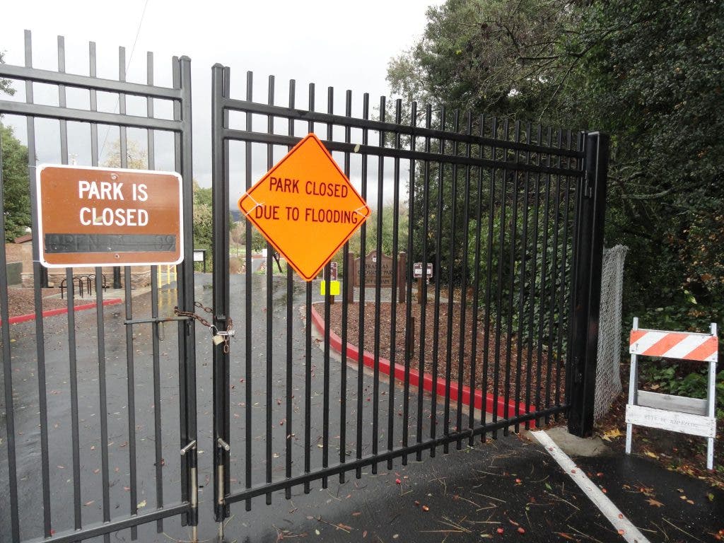
The water-carrying capacity of the river has been greatly increased by the Flood Project. As a precaution for public safety, Veterans Memorial Park and the Riverfront Promenade, as well the as Oxbow Preserve Park, will remain closed to the public throughout the day.
The third and final storm of the week brought the total rainfall for the week to 11.63 inches at the Mt. Veeder monitoring point and 7.38 inches at Lake Hennessy as of 8:00 a.m. today.
In addition to the Flood Warning, the area remains under a Flash Flood Watch that includes Napa and the North Bay through Monday, December 3.
The City's self-service sandbag operations will wind down later today as the storm threat recedes. The sandbag pickup point has been in the parking lot north of the Napa Premium Outlets on Freeway Drive near First Street.
Since Thursday, about 8,000 sandbags and 150 tons of sand have been dispensed. Those wanting sandbags should bring a shovel and gloves and be prepared to fill and transport their own bags. Residents in low-lying or flood-prone areas near creeks and streams are advised to remain watchful. To track rainfall amounts and river and creek levels, go to http://napa.onerain.com/home.php.
During winter storms, residents can report urgent problems with storm drains, trees and other concerns by going tocityofnapa.org and clicking on the “Service Center” link at the top of the page, or by calling 707-257-9223. For basic information on weather, river and stream levels, watches and warnings, call 707-258-7817.
For more about the storms on Napa Valley Patch:
- Real-Time Water Level Data for Napa River and Creeks
- Flash Flood Watch Extended in Napa County
- What to Do if the Power Goes Out: Safety Tips from PG&E
- Flood Warning for Napa River Issued Saturday
- Napa River Flood Warning Continues
- Watch: Flood Control Tames Napa Creek
- High Water in the Napa Valley: Share Photos Here
- Things to Do With Kids on Rainy Days in the Napa Valley
Stay Patched in! Follow Napa Valley Patch on Twitter | Like Napa Valley Patch on Facebook | Sign up for the daily email with links to the latest news | Got something to say? Start a blog and share your views.


